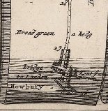
The Ogilby map of the road from Oxford to Newbury is the first road map of any quality for this section of the ‘A34’. For more information about Ogilby and his maps look on the ‘Overview’ section of this A34 blog. One of Ogilby’s strip map routes ran from Oxford to Chichester. The stretch from Oxford to Newbury ran along the ‘A34’. At Newbury, Ogilby’s route turned eastwards towards Basingstoke while the A34 continued due south to Winchester.


To our modern way of thinking Ogilby’s maps are upside down. In the first strip Oxford is shown at the bottom and the road proceeds for the most part in a roughly straight line upwards, but in fact southwards. The heading refers only to Berkshire because only a few hundred yards of the route lay in Oxfordshire in Ogilby’s time (1675) and right up to 1974. Berkshire started at Folly Bridge over the Thames or Isis.
The route of the road from Oxford to Abingdon has greatly changed over the centuries. The section over the Downs remains much as it was except that the modern road bypasses the once important sheep market of East Ilsley. In recent years the most southerly section, from Chieveley – which was always off the road – to Newbury has been massive changed, first as a result of the building of the Newbury bypass, highly controversial in its day, and then by the complex interchange between the A34,M4 and local roads.
And Chieveley is the venue for the Milestone Society’s Spring Meeting
in 2015 – on 16th May. Put the date in your diary now !!